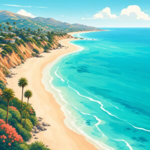
Guide to the City portion of this multi-use beach trail
One of the best amenities in San Clemente is the San Clemente Beach Trail. This 2.3 mile long multi-use trail starts on the north end at North Beach and meanders along the coast to the San Clemente State Park. The city managed section ends at Calafia Beach. Besides beginning a very scenic walk, you’ll pass by all of San Clemente’s beaches and ocean access points: North Beach, Dije, El Portal, Mariposa, Linda Lane, San Clemente Pier, T-Street, Lasuen (Lost Winds), Riviera, Calafia.
To access the trail you can start at North Beach where there is plenty of parking. The parking lot is shared between North Beach and the San Clemente Metrolink Station. The trail can also be accessed at any of the beach entrances. Usually, you’ll need to find parking on the bluff above and then climb down stairs or a ramps to the trail.
In addition to this long dirt path through San Clemente, the trail connects to other trails, enabling fitness and sports enthusiasts a very long path of one of the most scenic trails in the world. To the north, there is just a parking lot that separates the San Clemente Beach Trail with the protected paved bike path that runs along El Camino Real and then Pacific Coast Highway (PCH). To the south it continues through San Clemente State Park then to Trestles and San Onofre State Park. These are all parts of the California Coastal Trail (CCT), a multi modal interconnected public trail system being developed to span the 1,230 miles of coast between Mexico and Oregon.
Beginning of Trail: North Beach and north entrance
The trail starts at North Beach. The entrance to the beach trail is at the end of the parking lot shared by North Beach and the San Clemente Metro Link Station. Walk past the entrance to North Beach and you’ll find the beach sign and beginning of your journey.
Northern Section: North Beach to Linda Lane
The first 3/4 of a mile you will pass by a few entrances to the ocean with small beaches and train track platforms. These include Dije Court, El Portal, Mariposa, and Linda Lane. The section of trail from El Portal to Mariposa is a boardwalk.
Mid Section: San Clemente Pier and T-Street
The heart of San Clemente coast is the pier area. Starting from when the beach trail comes to beach level at Corto Lane through the San Clemente Pier to T-Street Beach, this is a busy area with many things to do.
South Section: Lasuen, Riviera, and Calafia
This section pass you through the southern beaches in San Clemente. These beaches are usually less busy due to their more remote nature. Each one of the beaches has an access point from the streets and bluff above where you can start or end your beach trail journey. While the end of the city managed portion of the trail is at Calafia, the trail still continues on through San Clemente State Beach to Trestles and San Onofre State Park.
San Clemente Coastal Trail History
The beach trail as we know it today has evolved throughout San Clemente’s past. In the early 2000s, the current design finally came to pass. After orginal trail designs were rejected in 1999 due to a citizen grassroots effort that protested a design that included a mini-highway and seawalls that interfered with the natural bluffs and habitats of the area. In a mission to balance the 2 million people who desire beach and ocean access with the 50 trains that pass through the City daily, the beach trail, a new design that was finally passed in 2003 with construction starting in 2005. Extensions of the trail beyond the Calafia south end point was launched in 2015.
Home | San Clemente | San Clemente Beach Trail
Beaches Along the Trail
- North Beach
- Dije Court
- El Portal
- Mariposa
- Linda Lane
- San Clemente Pier
- T-Street
- Lasuen
- Riviera
- Calafia
Related
- Walking tour of Dana Point